NASA Calibration Instrument Records First Measurements in Space
NASA Calibration Instrument Records First Measurements in Space
NASA’s Calibration Absolute Radiance and Refractivity Observatory Pathfinder, or CLARREO Pathfinder mission, reached a significant milestone this summer by achieving first light.
First light showcases a mission’s ability to successfully power on and capture data, in this case detailed spectral data, validating years of preparation and pre-launch testing. This moment marks the first time the instrument aboard the International Space Station collected science data measurements from space.
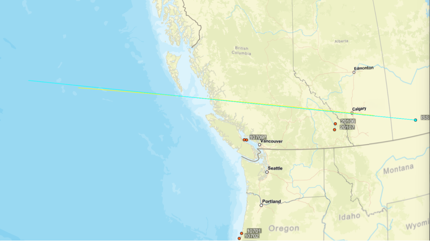
The CLARREO Pathfinder instrument is a hyperspectral imaging spectrometer capable of measuring sunlight reflected by Earth and the Moon with an uncertainty that is 5 to 10 times lower than existing sensors. The first measurements, taken over the western coast of Canada, captured a rich combination of ocean, land, and clouds. The CLARREO Pathfinder gathered reflected sunlight measurements over a period of five continuous minutes, resulting in an image that is about 43.5 miles wide and about 1,367 miles long.
The red-green-blue image composite below was created from CLARREO Pathfinder measurements in the red, green, and blue parts of the spectrum. The left side of the image corresponds to the western-most point of the yellow line in the map above, and the right side corresponds to the eastern-most point. Different types of clouds can be seen over the ocean on the left side and over land on the right side.
The data cube below illustrates a data set offered by hyperspectral measurements. The top of the data cube highlights a small section of the red-green-blue image, and the other two sides show additional details of light that human eyes cannot see. A hyperspectral instrument like CLARREO Pathfinder measures reflected sunlight in hundreds of spectral bands. The colors in the vertical stripes correspond to different amounts of sunlight reflected at more than 600 wavelength bands across the spectrum, representing a wealth of information about Earth. Each vertical stripe represents a different feature, such as clouds, ice, water, desert, and lush vegetation areas. The horizontal layers represent how different wavelengths of light are reflected by the Earth and its atmosphere. Together, the horizontal layers reveal complex and exciting stories of Earth, similar to a collection of pages in a book working together to convey a complete story. Scientists can use this information to better understand clouds, atmospheric particles, and land surfaces.
The CLARREO Pathfinder showcases cutting edge technology capable of improving data quality by creating a high-accuracy calibration standard for satellite sensors in government and commercial fleets. The mission is currently in its first phase of commissioning and will undergo science and instrument tests over the next several months.
이 뉴스, 어떠셨어요?
탭 한 번으로 반응 · 로그인 불필요