NASA, USGS Scientists Go Rock Hounding in California’s High Desert
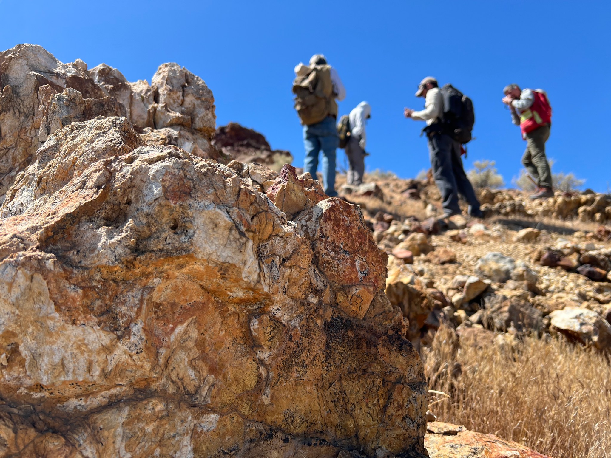
Geologists recently converged on a site near Barstow, California, to ground-truth a mineral discovery made on public land by a NASA JPL sensor flying aboard a plane overhead.
NASA/JPL-Caltech
Equipped with rock picks and hand lenses, a team of geoscientists deployed to the Mojave Desert recently to investigate a tantalizing “fingerprint” detected by a NASA sensor. Their target: a cache of topaz hiding in plain sight.
The geologists weren’t searching for gem-grade treasure. Rather, the presence of topaz could hint at a more valuable deposit below of something known as porphyry copper.
One of the world’s primary sources of copper, these deposits are left behind when magma and hot water from deep underground course through Earth’s crust, chemically transforming the surrounding rock. This tends to occur where one tectonic plate dives below another, known as a subduction zone, such as the North American Cordillera, which stretches from the Canadian Rockies to western Mexico.
California’s high desert stretches below a bright spring sky in April 2026. NASA and USGS scientists are using airborne remote sensing to home in on potential sources of critical minerals here and across the Western U.S.
NASA/JPL-Caltech
In addition to copper — the third most used metal in the world after steel and aluminum — the deposits can hold other critical minerals like molybdenum and tellurium, which are used in everything from steelmaking to solar panels. Finding the deposits isn’t easy. Geologists look for topaz because it forms under the same volcanic conditions.
For the team in the Mojave, the goal was to collect more evidence. That would require boots on the ground and a heavy bag of samples. The scientists who converged on the site included three experts from the U.S. Geological Survey (USGS) and Robert Green of NASA’s Jet Propulsion Laboratory in Southern California.
“What we’re doing out here is geologic CSI,” said Green, referring to the investigative TV show, as he split open a weathered red rock to expose a sparkling core. “We’re looking for clues to reconstruct what happened here.”
Three-dimensional image cubes illustrate the volume of data captured by NASA imaging spectrometers. The front face shows an aerial view of the Mojave Desert. The colorful side panels reveal what no eye or camera can detect: the spectral fingerprints of minerals present in every pixel.
NASA/JPL-Caltech
Next-generation mineral mapping
The sensor that detected the topaz deposit on public land near Barstow, California, was built at JPL. Called AVIRIS, short for Airborne Visible Infrared Imaging Spectrometer, it analyzes reflected sunlight and can be used to identify chemicals and minerals by their unique spectral fingerprint. The technology was pioneered in the early 1980s by a team that included Green, and space-hardened versions have explored the Moon, Mars, and other rocky bodies in the solar system in the decades since.
While its cousins study distant worlds aboard spacecraft, the AVIRIS line of sensors is advancing Earth science from aircraft. The latest model, AVIRIS-5, recently took to the skies for the first time as part of the NASA-USGS Geologic Earth Mapping Experiment (GEMx). The goal of GEMx is to identify sources of critical minerals across the American West, including in the waste rock of active and legacy mines. It is led by the USGS as part of its larger, nationwide initiative.
Carrying next-generation sensors, a high-altitude NASA ER-2 aircraft takes off from the agency’s Armstrong Flight Research Center in Edwards, California, on March 31, 2026, to support the GEMx mineral mapping campaign.
NASA/Carla Thomas
Since 2023, GEMx flights have covered more than 386,000 square miles (1 million square kilometers) of American soil, including most of California.
Ground-truthing the sensor data can entail hot field work, scrambling over steep crags to uncover samples for lab analysis. While testing has confirmed the topaz discovery, determining if the Mojave site overlies a porphyry copper deposit will require intensive investigation using ground-penetrating equipment. But the AVIRIS finding shows how advanced NASA airborne sensing can help lead geologists to the metaphorical needle in a haystack, even in heavily explored Southern California.
“People have been prospecting this area for generations,” said Erik Tharalson, a USGS geologist. “But there’s a lot more to discover.”
High flyer
From the beginning, the GEMx mineral mapping campaign has been enabled by one of the highest-flying aircraft in NASA’s fleet: the ER‑2. It deployed on March 31 from NASA’s Armstrong Flight Research Center in Edwards, California, to Colorado Springs Airport in Colorado.
“We deployed to Colorado Springs to maximize flight time for data collection needed in Colorado, Utah, New Mexico, Arizona, and Texas,” said John McGrath, ER‑2 project manager at NASA Armstrong.
By the conclusion of this deployment on June 5, the aircraft had completed 26 flights totaling more than 125 hours. Soaring at about 65,000 feet, the ER-2 can fly at high altitudes that allow it to collect broad‑area, high‑resolution spectral measurements in a single pass, supporting researchers studying mineral composition and surface processes.
In 2025, the aircraft flew 36 science missions, collecting more than 7 billion measurements over 200 flight hours. The data has contributed to the largest airborne surface mineralogy dataset gathered in a single NASA-USGS campaign.
The GEMx survey is led and funded by the USGS Earth Mapping Resources Initiative. Earth MRI is modernizing mapping the nation’s surface and subsurface to find new, critical, and other minerals. It is a partnership effort with 45 state geological surveys, federal agencies, private industry, tribes, universities, and others. The initiative will capitalize on both the technology developed by NASA for spectroscopic imaging, as well as the USGS expertise in analyzing the datasets, conducting field work, and deriving critical mineral information from them.
To learn more about GEMx visit:
https://science.nasa.gov/mission/gemx/
Media Contacts
Andrew Wang / Andrew Good
Jet Propulsion Laboratory, Pasadena, Calif.
626-379-6874 / 818-393-2433
andrew.wang@jpl.nasa.gov / andrew.c.good@jpl.nasa.gov
Written by Sally Younger
2026-037
Explore More
6 min read
Air Pollution’s Daily Pulse Over the Northeast
The TEMPO mission helped scientists track morning nitrogen dioxide that contributed to afternoon ozone along…
Article
12 hours ago
2 min read
NASA, NOAA to Hold Joint Session at 23rd Symposium on Operational Environmental Satellite Systems
Abstracts are now being accepted for the session, which will take place at the 2027…
Article
22 hours ago
9 min read
Jim Irons, Former Landsat Project Scientist, Wins Pecora Award
Landsat’s Jim Irons won the prestigious William T. Pecora Award. Irons, now an emeritus scientist at…
Article
1 day ago
Keep Exploring
Discover More Topics From NASA
GEMx
Armstrong Flight Research Center
Jet Propulsion Laboratory
Earth Science – Technology
이 뉴스, 어떠셨어요?
탭 한 번으로 반응 · 로그인 불필요