Utah Helicopter Flights Test NASA’s DAVINCI Mission to Venus
Utah Helicopter Flights Test NASA’s DAVINCI Mission to Venus
Before NASA sends its DAVINCI (Deep Atmosphere Venus Investigation of Noble gases, Chemistry, and Imaging) descent probe down through Venus’s thick atmosphere, scientists need to confirm that its cameras and instruments can do the job. During its 60-minute descent at Venus, the probe will capture images, measure the atmospheric chemistry, and explore the environment of a world no one has seen up close in this way.
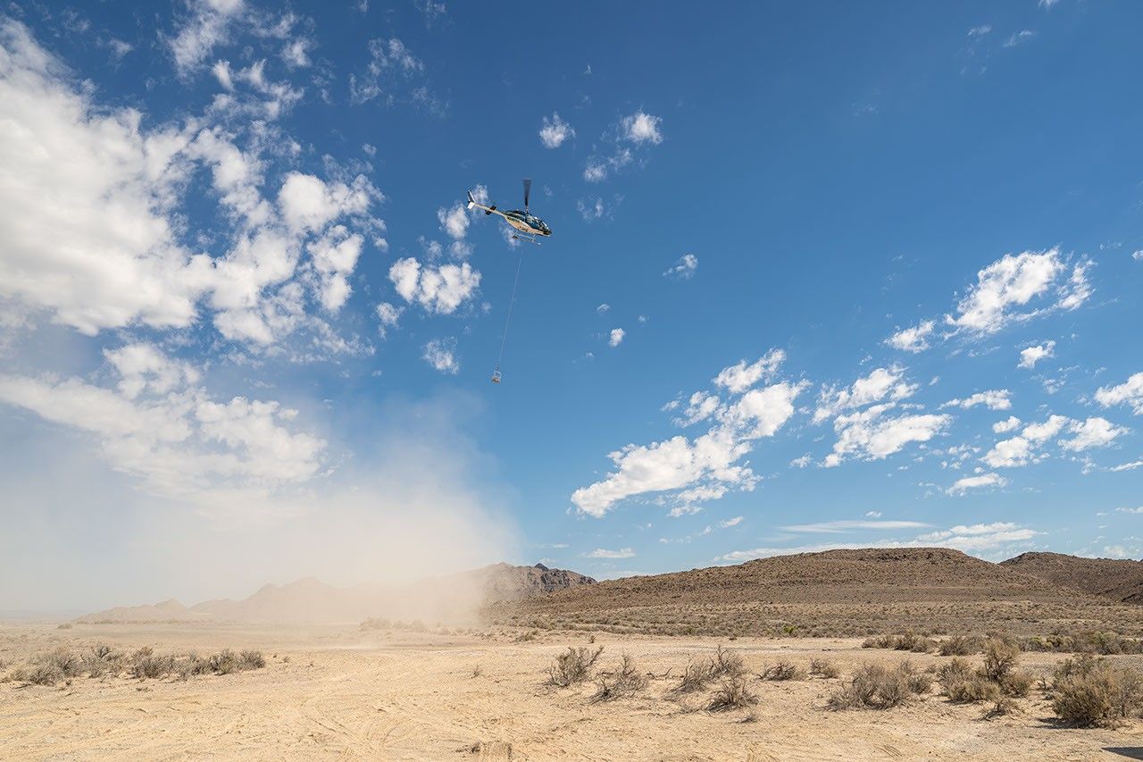
To prepare, a team of DAVINCI scientists and engineers traveled to Crater Island, Utah, in late June. There, they simulated the descent imaging part of their Venus mission through slow, near-vertical helicopter descents from altitudes as high as 18,000 feet to make sure they would be able to measure the landscapes using only optical and infrared images taken on the way down.
Venus’ surface is not well understood. Past spacecraft that made it to the surface glimpsed only small patches of ground, while radar-equipped orbiters at Venus gave scientists broad pictures of the planet. The DAVINCI probe will attempt to fill in the details between these micro and macro scales, as it sniffs out the gases in Venus’s atmosphere and snaps images while sinking toward the surface of a mountainous region called Alpha Regio. These images alone will need to reveal both the planet’s rugged topography and the chemical makeup of its rocks.
The imaging system was the star of the tests over Crater Island. DAVINCI scientists had to prove that they could stitch together hundreds of pictures taken from the helicopter payload to map the landscape and rock types of sites around the area. If DAVINCI’s maps matched official U.S. Geological Survey topographic and geologic maps, the team could trust the probe to do the same on Venus.
Crater Island is a complex of mountains in northern Utah, rising roughly half a mile into the sky above the neighboring salt flats. The mountain complex was once surrounded by water, thus the “island” in its name. Crater Island is the closest thing to Venus on Earth that the DAVINCI team could find after searching the globe for key geologic features that they think may be present in Alpha Regio, which scientists think could be an ancient continent possibly shaped by water.
Learning about the composition of rocks in Alpha Regio could help answer scientists’ biggest questions about Venus, including whether our neighboring planet once had oceans and Earth-like continents.
Crater Island also provided variety. Some areas match the predicted shapes and slopes of Alpha Regio’s terrain, while others contain different minerals the testing team’s infrared cameras could pick apart. Still others offered a spread of rock sizes, from boulders to baseball-sized fragments, that helped the team test whether the cameras could distinguish features that the DAVINCI probe will encounter on Venus.
The tests, conducted inside U.S. Air Force restricted airspace, included 10 helicopter flights to seven geological sites. With each flight, the helicopter ascended into the sky and then descended over nearly 40 minutes to the surface as the camera system snapped pictures.
The helicopter carried a metal basket of instruments that was suspended from a 50-foot cable. Inside the basket were nine instruments, including infrared cameras and pressure and temperature sensors that simulated the ones that will fly on the Venus probe, plus GPS units, gyroscopes, and a magnetometer to track the position and motion of the basket. The real-world reference data from the sensors helped determine if the researchers were interpreting the images correctly, which is important because descent images will be the only data scientists have to reconstruct, in extreme detail, the landscape of Alpha Regio.
Back at base camp between flights, imaging specialists downloaded each batch of pictures and used custom and commercial software to turn them into three-dimensional maps showing the topography and rock types of the area.
In total, the DAVINCI team collected three terabytes of information across the three-day campaign. Now, back at NASA’s Goddard Space Flight Center in Greenbelt, Maryland, the team will spend months on additional analysis refining their maps to glean more detail from them.
By the final day of the field campaign, the team had what they came for. From Utah’s dry lakebed floor to its ridgelines, scientists were able to recreate the landscape in detail using only the images acquired. Those reconstructions matched similar maps of the area created over many years by Utah state geologists, giving the DAVINCI team confidence that their imaging campaign also will work to reveal the geology of Alpha Regio.
Scientists also confirmed that the infrared images could distinguish key rock types, such as those rich in silica from others dominated by iron, which is a crucial capability for investigating the history of water on Venus and the geologic evolution of the planet.
For the people leading the effort, the test marked a leap forward. When DAVINCI launches, scientists will be confident that the probe can gather the information they need, thanks in part to a patch of high Utah desert that, for a few days, represented Venus on Earth.
By Lonnie Shekhtman
NASA’s Goddard Space Flight Center, Greenbelt, Md.
NASA's DAVINCI mission
DAVINCI will study the origin, evolution, and present state of Venus in unprecedented detail to help determine whether it was once wet and habitable, like Earth. Along with NASA's VERITAS, DAVINCI will be the first American spacecraft since the 1990s to explore Earth's neighboring planet.<br>
Learn MoreSimplified Summary
A series of helicopter tests in the most Venus-like location on Earth helped NASA's DAVINCI scientists test a probe that will one day descend through Venus's atmosphere.
이 뉴스, 어떠셨어요?
탭 한 번으로 반응 · 로그인 불필요