Lucia S. Tsaoussi, Ph.D.
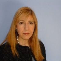
Lucia S. Tsaoussi, Ph.D.
Program Manager, Space Geodesy / Program Scientist GRACE mission series
Dr. Tsaoussi serves as the Program Manager for NASA’s Space Geodesy program since March 2025, providing programmatic direction to the program, including the geodetic networks (SLR, VLBI, GNSS), the data processing and research on geodesy and geodynamics, and serves as the Program Scientist (PS) for the Crustal Dynamics Data Information System (CDDIS).
Dr. Tsaoussi is the Program Scientist for the GRACE series satellite missions, a role that started with the GRACE mission while in extended operations and continues with the currently operating GRACE-FO mission, launched in 2018, and the mission in development GRACE-C. In this capacity she is a member of the HQ mission management team and the program manager of the interdisciplinary science team. In addition she is the program scientist for the NASA ESA collaboration on future gravity satellite missions, which was initiated in 2018. She co-chaired several joint working groups and teams to consolidate user requirements and led community engagement with international workshops. These efforts contributed to the implementation of the MAGIC (Mass-change & Geosciences International Constellation), comprised of 2 satellite pairs, a polar and an inclined.
Dr. Tsaoussi served as the Deputy Associate Director for Earth Science Research (September 2002 to March 2025). In that position she supported NASA’s Earth Science Division by planning, implementing, and managing the Research and Analysis program which advances understanding of the Earth’s system through the multidisciplinary exploitation of space-based, airborne, and ground observations. Her responsibilities involved managerial tasks in the areas of organizational management, personnel management, and representing the research program in government reporting processes and directorate policy forums, including serving as the Designated Federal Official for the Earth Science Advisory Committee. Additionally in that position she initiated, developed and managed several multi/interdisciplinary programs, such as a first ever NASA Climate Indicators competitive program and the Satellite Calibration Interconsistency Studies. Dr. Tsaoussi initiated and managed for two decades the MEaSUREs (Making Earth System data records for Use in Research Environments) successful program, which developed and produced valuable high level products and suites of data sets from multiple satellite time series; she also initiated and continues to manage the Remote Sensing Theory program making theoretical advancements in remote sensing and technique fusion.
Dr. Tsaoussi serves on interagency forums and working groups representing NASA’s ESD and supporting
interagency programs and plans, currently a co-chair of the Geodesy Community of Practice (GCoP) working group.
She served as the NASA co-chair of the USGEO Assessment Working Group leading the second Earth Observation Assessment and co-authoring the Integrated Assessment 2016 report. She was vice-chair of the Interagency Working Group for Ocean Observations (2006-2010), and member of the Joint Subcommittee for Oceans (2003-2005). She co-chaired the USGEO task force on Sea Level, leading the development of the Near-Term Opportunities in December 2005. She contributed to multiple interagency program planning efforts, most notably the Climate Change Science Program (CCSP) strategic plan of 2004 and the US Global Change Research Program strategic plan of 2011 as a core writing team member.
Dr. Tsaoussi started her federal career at NOAA’s Research Office as the climate team leader providing scientific advice to the Assistant Administrator in the areas related to Oceanic and Atmospheric Observing Systems, Satellite System Requirements, Climate Research and Services. She played a key role in the development of the Presidential Initiative on Climate Change Research (CCRI). As a voting member of the Joint Agency Requirements Group for the National Polar-orbiting Operational Environmental Satellite System (NPOESS), she led the NOAA climate requirements and established aerosols requirements resulting to the addition of the polarimeter to the NPOESS sensor suite. Other responsibilities included engaging in the development of initiatives and conceiving new programmatic directions for NOAA Research, in collaboration with NOAA scientists, the scientific community and stakeholders, such as the development of the NOAA-wide Climate Observations and Services Program.
Prior to joining NOAA, Dr. Tsaoussi was employed as a Principal Scientist at Raytheon ITSS, conducting research under contracts with the Oceans and Ice and Geodynamics and Space Geodesy Branches at NASA GSFC. As coinvestigator for the Ocean Altimetry Pathfinder project she was responsible for altimeter data calibration/validation, error assessment and modeling, using in situ data and Ocean Circulation Models and developed methodology and software for altimetry date validation with tide gauge data. As a member of the TOPEX/Poseidon Science Team developed an algorithm for calculating error models for the dynamic ocean topography, and the methodology to estimate the accuracy of the oceanic geoid by means of hydrographic data collected by the World Ocean Circulation Experiment cruise line data. Other work involved the analysis of TOPEX data to derive water level profiles over the Amazon River, investigating re-tracking algorithms to select valid signal returns over the river surface and used river gauge data to verify the results and assess the accuracy of the automated re-tracking, and retracking ERS-1 altimeter data to recover land topography and derive a Digital Elevation Model of South America. Her work in geodesy included: the implementation of modeling and processing of VLBI delay measurements in NASA’s precise orbit determination software (GEODYN); comparisons of the estimated Earth Orientation Parameters, polar motion and earth rotation, station coordinates and clock bias adjustments, and other model enhancements such as pole tide and the LAGEOS drag.
Dr. Tsaoussi holds a Dipl-Ing / M.Sc. in Civil and Surveying Engineering from the National Technical University of Athens, and M.Sc. and Ph.D. degrees in Geodetic Science from The Ohio State University. She earned graduate credits in Atmospheric Sciences from the University of Maryland College Park, and is a graduate of the Federal Executive Institute, Leadership for a Democratic Society program.
She is the recipient of many awards, most notably the NASA Exceptional Service Medal for outstanding service as Deputy Associate Director for the Earth Science Research and Analysis Program; NASA Headquarters Honor Award for Exceptional Performance; Department of Commerce / NOAA Bronze Medal Award for Superior Federal Service; Department of Commerce Silver Medal Award for Meritorious Federal Service; and the Weikko and Kaarina Heiskanen Junior Geodesist Award, The Ohio State University. She was named an Ohio State University Distinguished Alumnus (2011), in recognition of her eminent contributions to the advancement of her profession and related field of activities.
이 뉴스, 어떠셨어요?
탭 한 번으로 반응 · 로그인 불필요